 Daniel Milner Dan works for the RHoMIS team in Bristol, UK, processing and analysing household survey data to provide insight. He has a background in economic geography and development both in the UK and internationally. Editor: We are pleased to welcome a new member to the RHoMIS team, Dan Milner. Joining us at the end of 2019, Dan has already injected fresh energy, expertise and a passion for GIS and data management. In this brief article he shares a little of his background, where he has already used RHoMIS extensively in his Postgraduate studies, as well as what he hopes to achieve in the role. Having joined RHoMIS in December 2019 the past two months have been an energising introduction to the team’s work. In September I completed an MSc in Environmental Policy and Management at Bristol University (more on this in a minute), which is where I first became aware of RHoMIS and the great work the ILRI team are doing. As a forward thinking and constantly evolving product, the day-to-day activities of the RHoMIS team always strives towards improvement, increased automation and greater efficiency. This progressive culture has provided a thoroughly enjoyable environment for my role processing and analysing the RHoMIS-generated data. Prior to joining the team I had the privilege of varied career experiences ranging from farm worker on an agricultural cooperative in northern Spain to Economist at global infrastructure corporation AECOM. Tying these disparate activities together is my deep-rooted interest in the nexus of food systems, the environment and economic development that improves outcomes for less advantaged people. Stemming from this, my research interests focus particularly on spatial statistics and the impact of geography on development outcomes. I studied Economics and Geography at undergraduate level in Liverpool before doing an MSc in Economics at Strathclyde University whilst working as an Economist for a regional development agency in the UK. After nearly a decade in industry, in 2017 I decided I wanted to up-skill and embarked on a second Masters degree (I’m a sucker for punishment!). For my dissertation, I teamed-up with RHoMIS to investigate how market access influences household dietary diversity in Sub-Saharan African.
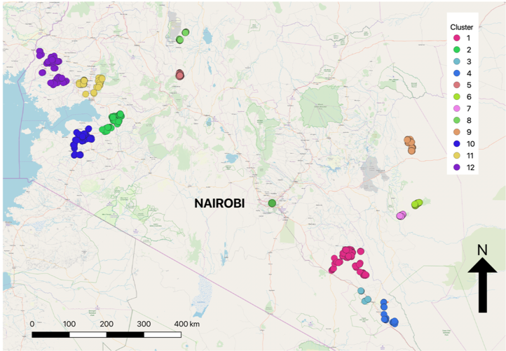
A Geographical Information Systems (GIS) approach was used along with OpenStreetMaps’ Open Source Route Mapper (OSRM) to calculate the shortest travel times to market from each of the 1,300 RHoMIS households. The clustering algorithm DBSCAN (Density Based Spatial Clustering Application with Noise) was used to group households based on their spatial proximity to each other - the premise for this was based on Tobler’s (1970) first law of geography, “everything is related to everything else, but near things are more related than distant things”. Finally, travel time data and clustering allocations were combined with multiple variables from the RHoMIS dataset and modelled using Bayesian probabilistic programming techniques. Findings were not necessarily what I was expecting and improving market access was definitely not found to be a panacea. Some of the headline findings:
Overall, its seems the optimum formula for a rural household is to cultivate between 1 and 2 ha, grow a mixture of commercial crops and crops for home consumption, be located between 5 and 10 minute walk to a road and within 20 minutes drive to a physical market. I thoroughly enjoyed the dissertation process and I am very much looking forward to the year ahead working with the team and getting to know more of the RHoMIS community of practice. Please feel free to contact me via email here. Select references:
0 Comments
Your comment will be posted after it is approved.
Leave a Reply. |
RHoMIS BlogThe RHoMIS blog is written by a community of practice. The COP is made up of RHoMIS users and creators from across the world. Here we share their stories of how RHoMIS is helping to record and analyse household data. Archives
May 2020
Categories
All
|


 RSS Feed